
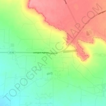
Maljamar topographic map
Interactive map
Click on the map to display elevation.
About this map
Name: Maljamar topographic map, elevation, terrain.
Location: Maljamar, Lea County, New Mexico, 88264, United States (32.83623 -103.78273 32.87623 -103.74273)
Average elevation: 1,270 m
Minimum elevation: 1,226 m
Maximum elevation: 1,319 m