Geolocate

Kangeta topographic map

Interactive map

Click on the map to display elevation.

About this map

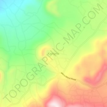
Name: Kangeta topographic map, elevation, terrain.

Location: Kangeta, Igembe Central, Meru County, Eastern, Kenya (0.26330 37.86330 0.30330 37.90330)

Average elevation: 1,779 m

Minimum elevation: 1,510 m

Maximum elevation: 2,100 m

Other topographic maps

Click on a map to view its topography, its elevation and its terrain.

Meru National Park

Kenya > Meru County > Igembe Central

Meru National Park, Igembe Central, Meru County, Eastern, Kenya

Average elevation: 605 m

Nyambene Hills

Kenya > Meru County > Igembe Central

Nyambene Hills, Igembe Central, Meru County, Eastern, 60600, Kenya

Average elevation: 2,283 m