
Kitere topographic map
Interactive map
Click on the map to display elevation.
About this map
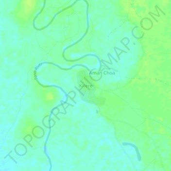
Name: Kitere topographic map, elevation, terrain.
Location: Kitere, Garsen, Tana River County, Kenya (-1.97518 40.12628 -1.93518 40.16628)
Average elevation: 34 m
Minimum elevation: 28 m
Maximum elevation: 39 m
Other topographic maps
Click on a map to view its topography, its elevation and its terrain.
Kulesa
Kenya > Tana River County > Garsen
Kulesa, Garsen, Tana River County, Kenya
Average elevation: 18 m
Delta Dunes Car Park
Kenya > Tana River County > Garsen
Delta Dunes Car Park, Garsen, Tana River County, Kenya
Average elevation: 2 m
Kipini
Kenya > Tana River County > Garsen
Kipini, Garsen, Tana River County, Coastal Kenya, Kenya
Average elevation: 5 m