
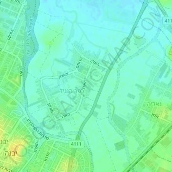
Kefar HaNagid topographic map
Interactive map
Click on the map to display elevation.
About this map
Name: Kefar HaNagid topographic map, elevation, terrain.
Average elevation: 21 m
Minimum elevation: 14 m
Maximum elevation: 36 m
Other topographic maps
Click on a map to view its topography, its elevation and its terrain.
Palmachim
Israel > Center District > Gan Rave Regional Council
Palmachim, Gan Rave Regional Council, Rehovot Subdistrict, Center District, Israel
Average elevation: 9 m
Palmahim
Israel > Center District > Gan Rave Regional Council
Palmahim, Gan Rave Regional Council, Rehovot Subdistrict, Center District, Israel
Average elevation: 9 m