
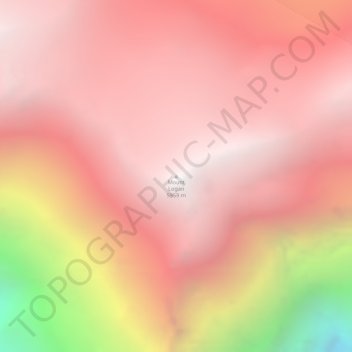
Mount Logan topographic map
Interactive map
Click on the map to display elevation.
About this map
Name: Mount Logan topographic map, elevation, terrain.
Location: Mount Logan, Yukon, Canada (60.56780 -140.40574 60.56790 -140.40564)
Average elevation: 5,292 m
Minimum elevation: 3,655 m
Maximum elevation: 5,943 m
Due to active tectonic uplifting, Mount Logan is still rising in height (approximately 0.35 mm per year). Before 1992, the exact elevation of Mount Logan was unknown and measurements ranged from 5,959 to 6,050 metres (19,551 to 19,849 ft). In May 1992, a GSC expedition climbed Mount Logan and fixed the current height of 5,959 metres (19,551 ft) using GPS.
Other topographic maps
Click on a map to view its topography, its elevation and its terrain.
Kluane National Park and Reserve
Kluane National Park and Reserve, Yukon, Canada
Average elevation: 1,536 m
Two Mile Village
Canada > Yukon > Watson Lake
Two Mile Village, Watson Lake, Yukon, Y0A 1C0, Canada
Average elevation: 703 m
Destruction Bay
Canada > Yukon > Destruction Bay
Destruction Bay, Yukon, Y0B 1H0, Canada
Average elevation: 893 m
Dawson City
Canada > Yukon > Dawson City > Dawson City
Dawson City, Yukon, Y0B 1G0, Canada
Average elevation: 510 m
Yukon, Unorganized
City of Whitehorse, Yukon, Unorganized, Yukon, Canada
Average elevation: 1,010 m
Swift River
Canada > Yukon > Swift River
Swift River, Yukon, Unorganized, Yukon, Canada
Average elevation: 1,086 m