
Quirihue topographic map
Interactive map
Click on the map to display elevation.
About this map
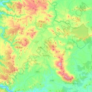
Name: Quirihue topographic map, elevation, terrain.
Location: Quirihue, Provincia de Itata, Región de Ñuble, Chile (-36.42634 -72.70675 -36.06426 -72.33542)
Average elevation: 279 m
Minimum elevation: 2 m
Maximum elevation: 889 m