
Hammerstatt / Sankt Georgen topographic map
Interactive map
Click on the map to display elevation.
About this map
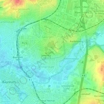
Name: Hammerstatt / Sankt Georgen topographic map, elevation, terrain.
Location: Hammerstatt / Sankt Georgen, Bayreuth, Bavaria, Germany (49.94208 11.57831 49.95880 11.60776)
Average elevation: 356 m
Minimum elevation: 337 m
Maximum elevation: 396 m
Other topographic maps
Click on a map to view its topography, its elevation and its terrain.