
Ehrenbreitstein topographic map
Interactive map
Click on the map to display elevation.
About this map
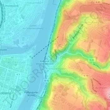
Name: Ehrenbreitstein topographic map, elevation, terrain.
Location: Ehrenbreitstein, Koblenz, Rijnland-Palts, 56077, Duitsland (50.35593 7.60659 50.36924 7.63660)
Average elevation: 119 m
Minimum elevation: 62 m
Maximum elevation: 220 m
Other topographic maps
Click on a map to view its topography, its elevation and its terrain.
Koblenz
Duitsland > Rijnland-Palts > Koblenz
Koblenz, Rijnland-Palts, 56068, Duitsland
Average elevation: 240 m