
Setúbal topographic map
Interactive map
Click on the map to display elevation.
About this map
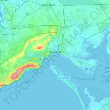
Name: Setúbal topographic map, elevation, terrain.
Location: Setúbal, Portugal (38.45396 -9.05562 38.58072 -8.73139)
Average elevation: 35 m
Minimum elevation: -4 m
Maximum elevation: 483 m
Other topographic maps
Click on a map to view its topography, its elevation and its terrain.