
Trendelburg topographic map
Interactive map
Click on the map to display elevation.
About this map
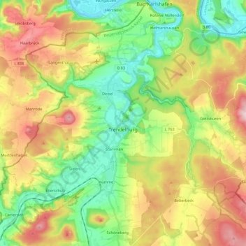
Name: Trendelburg topographic map, elevation, terrain.
Location: Trendelburg, Landkreis Kassel, Hessen, 34388, Deutschland (51.52733 9.31919 51.62677 9.53665)
Average elevation: 225 m
Minimum elevation: 93 m
Maximum elevation: 413 m