Geolocate

Rush topographic map

Click on the map to display elevation.

About this map

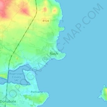
Name: Rush topographic map, elevation, terrain.

Location: Rush, Fingal, County Dublin, Leinster, K56 ED95, Ireland (53.48204 -6.13090 53.56204 -6.05090)

Average elevation: 11 m

Minimum elevation: -1 m

Maximum elevation: 76 m

Other topographic maps

Click on a map to view its topography, its elevation and its terrain.

Gear up for your next adventure:

📕Outdoor Navigation Books - Learn traditional and modern navigation techniques
🗺️Ordnance Survey Maps - Official UK maps for walking and outdoor activities
🔥Emergency Fire Starters - Reliable ignition tools for survival situations in damp conditions
🌄Outdoor Binoculars - Compact binoculars for landscape observation
📍Handheld GPS Navigators - Reliable satellite navigation for hiking and off-road exploration

As an Amazon Associate, this site earns from qualifying purchases at no extra cost to you.