
Thank you for supporting this site ❤️
Make a donation
Make a donation
Gear up for your next adventure:
As an Amazon Associate, this site earns from qualifying purchases at no extra cost to you.
Filiel topographic map
Click on the map to display elevation.
Thank you for supporting this site ❤️
Make a donation
Make a donation
Gear up for your next adventure:
As an Amazon Associate, this site earns from qualifying purchases at no extra cost to you.
About this map
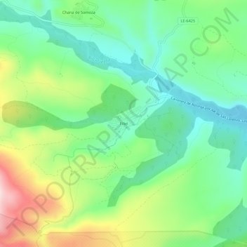
Name: Filiel topographic map, elevation, terrain.
Location: Filiel, Lucillo, León, Castile and León, 24723, Spain (42.35819 -6.35338 42.39819 -6.31338)
Average elevation: 1,172 m
Minimum elevation: 1,053 m
Maximum elevation: 1,401 m
Thank you for supporting this site ❤️
Make a donation
Make a donation
Gear up for your next adventure:
As an Amazon Associate, this site earns from qualifying purchases at no extra cost to you.