
Cochas Chico topographic map
Interactive map
Click on the map to display elevation.
About this map
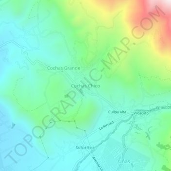
Name: Cochas Chico topographic map, elevation, terrain.
Location: Cochas Chico, El Tambo, Huancayo, Junín, 12002, Perú (-12.02674 -75.21477 -11.98674 -75.17477)
Average elevation: 3,521 m
Minimum elevation: 3,310 m
Maximum elevation: 4,162 m
Other topographic maps
Click on a map to view its topography, its elevation and its terrain.
Cochas Grande
Cochas Grande, El Tambo, Huancayo, Junín, 12002, Perú
Average elevation: 3,514 m
Cullpa Alta
Perú > Junín > El Tambo > Cochas Chico
Cullpa Alta, Cochas Chico, El Tambo, Huancayo, Junín, 12002, Perú
Average elevation: 3,541 m