Geolocate

Alun topographic map

Click on the map to display elevation.

About this map

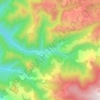
Name: Alun topographic map, elevation, terrain.

Location: Alun, Boșorod, Hunedoara, 337096, Romania (45.58855 23.13970 45.62855 23.17970)

Average elevation: 765 m

Minimum elevation: 445 m

Maximum elevation: 1,109 m

Gear up for your next adventure:

Altimeter Watches - Watches measuring altitude for mountain activities
🧤Thermal Touchscreen Gloves - Stay warm while operating your GPS or smartphone camera
🛰️Satellite Messengers - Emergency communication devices for areas without mobile signal
🧰Survival Kits - Emergency tools for remote environments
🚲Bikepacking Frame Bags - Storage for tools and navigation gear on long off-road rides

As an Amazon Associate, this site earns from qualifying purchases at no extra cost to you.