
San Agustín topographic map
Interactive map
Click on the map to display elevation.
About this map
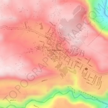
Name: San Agustín topographic map, elevation, terrain.
Average elevation: 1,633 m
Minimum elevation: 1,324 m
Maximum elevation: 1,731 m
Other topographic maps
Click on a map to view its topography, its elevation and its terrain.
Paramo Del Buey
Colombia > Huila > San Agustín
Paramo Del Buey, San Agustín, Sur, Huila, Colombia
Average elevation: 2,777 m
San Agustin
Colombia > Huila > San Agustín > San Agustin
San Agustin, San Agustín, Sur, Huila, Región Andina, 418060, Colombia
Average elevation: 1,687 m