
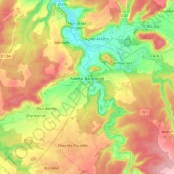
Andelot-Blancheville topographic map
Interactive map
Click on the map to display elevation.
About this map
Name: Andelot-Blancheville topographic map, elevation, terrain.
Average elevation: 319 m
Minimum elevation: 228 m
Maximum elevation: 413 m
Other topographic maps
Click on a map to view its topography, its elevation and its terrain.
La Trace
France > Grand Est > Haute-Marne > Roches-Bettaincourt > Bettaincourt-sur-Rognon
Average elevation: 271 m