
Marmari topographic map
Interactive map
Click on the map to display elevation.
About this map
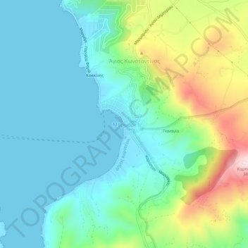
Name: Marmari topographic map, elevation, terrain.
Average elevation: 99 m
Minimum elevation: 0 m
Maximum elevation: 380 m
Other topographic maps
Click on a map to view its topography, its elevation and its terrain.
Kokkinis
Greece > Thessaly and Central Greece > Euboea Regional Unit > Agios Konstantinos
Average elevation: 75 m
Xirovrysi
Greece > Thessaly and Central Greece > Euboea Regional Unit > Municipal Unit of Anthidon
Average elevation: 15 m