
Greimharting topographic map
Interactive map
Click on the map to display elevation.
About this map
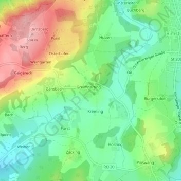
Name: Greimharting topographic map, elevation, terrain.
Location: Greimharting, Landkreis Rosenheim, Bayern, Deutschland (47.86822 12.31517 47.87079 12.32105)
Average elevation: 589 m
Minimum elevation: 522 m
Maximum elevation: 696 m