
Kremsmünster topographic map
Interactive map
Click on the map to display elevation.
About this map
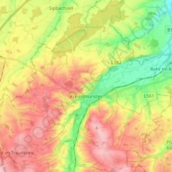
Name: Kremsmünster topographic map, elevation, terrain.
Location: Kremsmünster, Bezirk Kirchdorf, Upper Austria, 4550, Austria (48.01563 14.07260 48.10118 14.19180)
Average elevation: 403 m
Minimum elevation: 309 m
Maximum elevation: 494 m
Other topographic maps
Click on a map to view its topography, its elevation and its terrain.
Inzersdorf im Kremstal
Austria > Upper Austria > Bezirk Kirchdorf > Inzersdorf im Kremstal
Inzersdorf im Kremstal, Bezirk Kirchdorf, Upper Austria, 4565, Austria
Average elevation: 570 m