Geolocate

Sheet topographic map

Click on the map to display elevation.

About this map

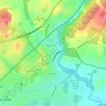
Name: Sheet topographic map, elevation, terrain.

Location: Sheet, East Hampshire, Hampshire, England, United Kingdom (51.00780 -0.92926 51.02082 -0.90746)

Average elevation: 70 m

Minimum elevation: 44 m

Maximum elevation: 109 m

Hampshire trails, hiking, mountain biking, running and outdoor activities

Gear up for your next adventure:

🧭Orienteering Compasses - Accurate compasses for map-based navigation
👟Men's Trail Running Shoes - Lightweight grip for fast movement over topographic contours
🎒Replacement Sternum Straps - Repair parts for hiking rucksacks
🕶️Glacier Goggles - Maximum protection for high-altitude snow topography
🎒Hiking Daypacks (20L) - Compact backpacks for day trips and technical mountain ascents

As an Amazon Associate, this site earns from qualifying purchases at no extra cost to you.