
Anda topographic map
Interactive map
Click on the map to display elevation.
About this map
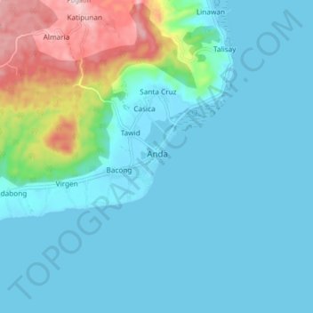
Name: Anda topographic map, elevation, terrain.
Location: Anda, Bohol, Bisayas Centrales, 6311, Filipinas (9.70303 124.53557 9.78303 124.61557)
Average elevation: 59 m
Minimum elevation: -1 m
Maximum elevation: 341 m