Geolocate

Owasso topographic map

Click on the map to display elevation.

About this map
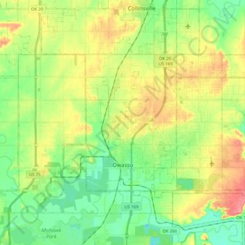
Name: Owasso topographic map, elevation, terrain.

Location: Owasso, Tulsa County, Oklahoma, 74055, United States (36.24886 -95.90201 36.33668 -95.70774)

Average elevation: 199 m

Minimum elevation: 163 m

Maximum elevation: 250 m

Other topographic maps

Click on a map to view its topography, its elevation and its terrain.
Turley

United States > Oklahoma > Tulsa County

Average elevation: 206 m

Gear up for your next adventure:

🗺️Ordnance Survey Maps - Official UK maps for walking and outdoor activities
👖Packable Overtrousers - Quick-deploy rain protection for legs in sudden storms
📢Survival Whistles - Essential safety gear for signaling for help in mountain fog
📚UK Hiking Guidebooks - Detailed route descriptions for the Lake District, Peaks, and Highlands
🧰First Aid Kits - Essential safety kits for outdoor activities

As an Amazon Associate, this site earns from qualifying purchases at no extra cost to you.