
Rio Negro topographic map
Interactive map
Click on the map to display elevation.
About this map
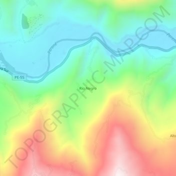
Name: Rio Negro topographic map, elevation, terrain.
Location: Rio Negro, Perené, Chanchamayo, Junín, Peru (-10.96162 -75.18242 -10.92162 -75.14242)
Average elevation: 900 m
Minimum elevation: 571 m
Maximum elevation: 1,446 m