
Rothenthurm topographic map
Interactive map
Click on the map to display elevation.
About this map
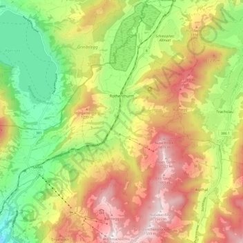
Name: Rothenthurm topographic map, elevation, terrain.
Location: Rothenthurm, Schwyz, 6418, Suiza (47.05562 8.64932 47.13668 8.71212)
Average elevation: 1,035 m
Minimum elevation: 563 m
Maximum elevation: 1,556 m