
Busanjin-gu topographic map
Interactive map
Click on the map to display elevation.
About this map
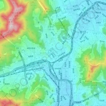
Name: Busanjin-gu topographic map, elevation, terrain.
Location: Busanjin-gu, Busan, South Korea (35.13467 129.00990 35.19939 129.08301)
Average elevation: 128 m
Minimum elevation: 1 m
Maximum elevation: 610 m