
Clevedon topographic map
Click on the map to display elevation.
About this map
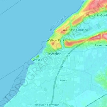
Name: Clevedon topographic map, elevation, terrain.
Location: Clevedon, North Somerset, England, BS21 6NA, United Kingdom (51.39606 -2.89265 51.47606 -2.81265)
Average elevation: 10 m
Minimum elevation: 0 m
Maximum elevation: 118 m
North Somerset trails, hiking, mountain biking, running and outdoor activities
Other topographic maps
Click on a map to view its topography, its elevation and its terrain.
Portishead Quays Marina
United Kingdom > England > North Somerset > Portishead > North Weston
Average elevation: 11 m