Geolocate

Hoodsport topographic map

Interactive map

Click on the map to display elevation.

About this map

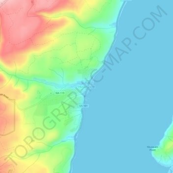
Name: Hoodsport topographic map, elevation, terrain.

Location: Hoodsport, Mason County, Washington, 98548, United States (47.38597 -123.16124 47.42597 -123.12124)

Average elevation: 62 m

Minimum elevation: -3 m

Maximum elevation: 224 m

Other topographic maps

Click on a map to view its topography, its elevation and its terrain.

Price Lake

United States > Washington > Mason County

Average elevation: 326 m

Oakland Bay

United States > Washington > Mason County > Shelton

Average elevation: 36 m

Shelton

United States > Washington > Mason County

Average elevation: 54 m

Lake Cushman

United States > Washington > Mason County

Average elevation: 410 m

Allyn

United States > Washington > Mason County > Allyn

Average elevation: 47 m

Shelton

United States > Washington > Mason County

Average elevation: 54 m