
Thank you for supporting this site ❤️
Make a donation
Make a donation
Gear up for your next adventure:
As an Amazon Associate, this site earns from qualifying purchases at no extra cost to you.
Lardosa topographic map
Click on the map to display elevation.
Thank you for supporting this site ❤️
Make a donation
Make a donation
Gear up for your next adventure:
As an Amazon Associate, this site earns from qualifying purchases at no extra cost to you.
About this map
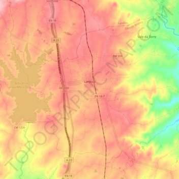
Name: Lardosa topographic map, elevation, terrain.
Location: Lardosa, Castelo Branco, 6005-193, Portugal (39.94925 -7.48987 40.01939 -7.37898)
Average elevation: 381 m
Minimum elevation: 288 m
Maximum elevation: 432 m
Thank you for supporting this site ❤️
Make a donation
Make a donation
Gear up for your next adventure:
As an Amazon Associate, this site earns from qualifying purchases at no extra cost to you.
Other topographic maps
Click on a map to view its topography, its elevation and its terrain.
Monte Gordo
Portugal > Castelo Branco > Castelo Branco > Santo André das Tojeiras
Average elevation: 285 m