
Драгиевци topographic map
Interactive map
Click on the map to display elevation.
About this map
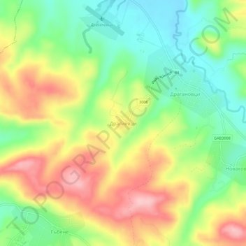
Name: Драгиевци topographic map, elevation, terrain.
Location: Драгиевци, Габрово, 5347, Bulgarije (42.90661 25.15318 42.94661 25.19318)
Average elevation: 314 m
Minimum elevation: 243 m
Maximum elevation: 401 m