Geolocate

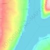
Painted Post topographic map

Click on the map to display elevation.

About this map

Name: Painted Post topographic map, elevation, terrain.

Location: Painted Post, Town of Erwin, Steuben County, New York, United States (42.14697 -77.10543 42.18077 -77.08483)

Average elevation: 328 m

Minimum elevation: 278 m

Maximum elevation: 491 m

Other topographic maps

Click on a map to view its topography, its elevation and its terrain.
Wileyville

United States > New York > Steuben County

Average elevation: 673 m

Rexville

United States > New York > Steuben County

Average elevation: 649 m

Dyke

United States > New York > Steuben County > Town of Hornby

Average elevation: 517 m

Erwin

United States > New York > Steuben County

Average elevation: 447 m

Keuka

United States > New York > Steuben County > Keuka

Average elevation: 282 m

Gear up for your next adventure:

🌄Outdoor Binoculars - Compact binoculars for landscape observation
🦟Anti-Midge & Tick Repellent - Vital for hiking in the Scottish Highlands during summer
🖼️Topographic Map Art - Decorative 3D-effect posters of famous UK peaks and regions
🥫Expedition Meals - Lightweight, high-calorie nutrition for long-distance hikers
📍Handheld GPS Navigators - Reliable satellite navigation for hiking and off-road exploration

As an Amazon Associate, this site earns from qualifying purchases at no extra cost to you.