Geolocate

Matingain I topographic map

Click on the map to display elevation.

About this map

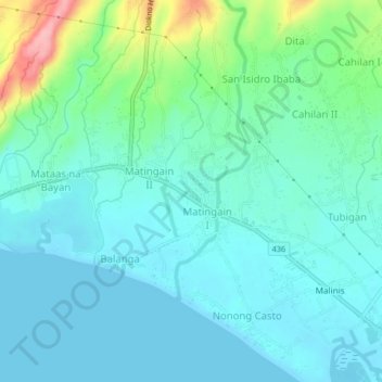
Name: Matingain I topographic map, elevation, terrain.

Location: Matingain I, Lemery, Batangas, Calabarzon, 4209, Philippines (13.89088 120.86520 13.93088 120.90520)

Average elevation: 27 m

Minimum elevation: 0 m

Maximum elevation: 134 m

Gear up for your next adventure:

📐Altimeters & Barometers - Tools for measuring altitude and air pressure
🎒Hiking Daypacks (20L) - Compact backpacks for day trips and technical mountain ascents
📷Camera Straps - Secure straps for carrying cameras while walking
❄️Walking Crampons - Added traction for icy slopes and winter peak bagging
🎒Hiking Daypacks - Compact backpacks ideal for short hikes and excursions

As an Amazon Associate, this site earns from qualifying purchases at no extra cost to you.