
La Mana topographic map
Interactive map
Click on the map to display elevation.
About this map
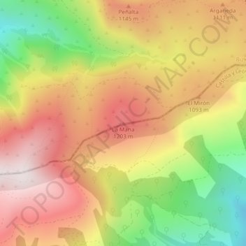
Name: La Mana topographic map, elevation, terrain.
Location: La Mana, Valle de Carranza, Vizcaya, País Vasco, España (43.13969 -3.39451 43.13979 -3.39441)
Average elevation: 999 m
Minimum elevation: 590 m
Maximum elevation: 1,328 m