
Thank you for supporting this site ❤️
Make a donation
Make a donation
Gear up for your next adventure:
As an Amazon Associate, this site earns from qualifying purchases at no extra cost to you.
Moron topographic map
Click on the map to display elevation.
Thank you for supporting this site ❤️
Make a donation
Make a donation
Gear up for your next adventure:
As an Amazon Associate, this site earns from qualifying purchases at no extra cost to you.
About this map
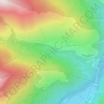
Name: Moron topographic map, elevation, terrain.
Location: Moron, Bausen, Val d'Aran, Lleida, Catalonia, 25549, Spain (42.82303 0.69939 42.84303 0.71939)
Average elevation: 1,060 m
Minimum elevation: 607 m
Maximum elevation: 1,715 m
Thank you for supporting this site ❤️
Make a donation
Make a donation
Gear up for your next adventure:
As an Amazon Associate, this site earns from qualifying purchases at no extra cost to you.