

Bargarh topographic map
Click on the map to display elevation.
Bargarh
Bargarh is located in Western Odisha, close to the border of neighboring state of Chhattisgarh. It is positioned at 21°20′N 83°37′E / 21.33°N 83.62°E / 21.33; 83.62 with an average elevation of 171 meter (561 feet). The Bargarh district lies in the Plain with Eastern Ghats running close to the town. As per the earthquake zoning of India, Bargarh falls in the zone 2 category, the least earthquake prone zone.
About this map
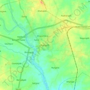
Name: Bargarh topographic map, elevation, terrain.
Location: Bargarh, Odisha, 768028, India (21.29350 83.57905 21.37350 83.65905)
Average elevation: 173 m
Minimum elevation: 157 m
Maximum elevation: 198 m