Geolocate

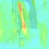
Crystal Beach topographic map

Click on the map to display elevation.

About this map

Name: Crystal Beach topographic map, elevation, terrain.

Location: Crystal Beach, Town of Gorham, Ontario County, New York, United States (42.79946 -77.26682 42.81985 -77.24261)

Average elevation: 229 m

Minimum elevation: 209 m

Maximum elevation: 285 m

Other topographic maps

Click on a map to view its topography, its elevation and its terrain.

Seneca Castle

United States > New York > Ontario County

Average elevation: 244 m

Stanley

United States > New York > Ontario County

Average elevation: 275 m

Seneca Castle

United States > New York > Ontario County

Average elevation: 244 m

Gear up for your next adventure:

🥤Hydration Bladders - Hands-free hydration systems for backpacks
🧗Locking Carabiners - Secure gear to your pack or for light technical use
🚲Bikepacking Frame Bags - Storage for tools and navigation gear on long off-road rides
🥾Hiking Boot Waterproofing Wax - Maintain the lifespan of your leather trekking boots
🧢Waterproof Hiking Hats - Keep the rain off your face while studying topographic maps

As an Amazon Associate, this site earns from qualifying purchases at no extra cost to you.