
Thank you for supporting this site ❤️
Make a donation
Make a donation
Gear up for your next adventure:
As an Amazon Associate, this site earns from qualifying purchases at no extra cost to you.
Gundamal topographic map
Click on the map to display elevation.
Thank you for supporting this site ❤️
Make a donation
Make a donation
Gear up for your next adventure:
As an Amazon Associate, this site earns from qualifying purchases at no extra cost to you.
About this map
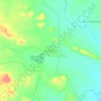
Name: Gundamal topographic map, elevation, terrain.
Location: Gundamal, Kosgi mandal, Narayanpet, Telangana, India (16.87438 77.69048 16.91438 77.73048)
Average elevation: 489 m
Minimum elevation: 456 m
Maximum elevation: 556 m
Thank you for supporting this site ❤️
Make a donation
Make a donation
Gear up for your next adventure:
As an Amazon Associate, this site earns from qualifying purchases at no extra cost to you.