
Forest River topographic map
Interactive map
Click on the map to display elevation.
About this map
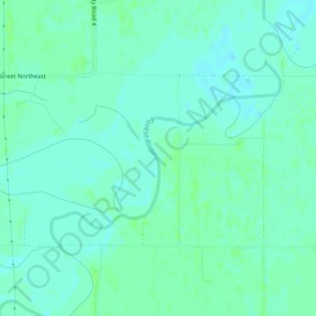
Name: Forest River topographic map, elevation, terrain.
Location: Forest River, Walsh County, North Dakota, USA (48.26876 -97.25089 48.27907 -97.23664)
Average elevation: 245 m
Minimum elevation: 241 m
Maximum elevation: 249 m
Other topographic maps
Click on a map to view its topography, its elevation and its terrain.
Lake Sakakawea
Lake Sakakawea, McLean County, North Dakota, USA
Average elevation: 651 m
Theodore Roosevelt National Park
Theodore Roosevelt National Park, Billings County, North Dakota, USA
Average elevation: 684 m
Rock Lake
USA > North Dakota > Rock Lake
Rock Lake, Towner County, North Dakota, USA
Average elevation: 472 m
Lake Ashtabula
Lake Ashtabula, 15th Street Southeast, Barnes County, North Dakota, 58056, USA
Average elevation: 423 m
Lake Tschida
Lake Tschida, 56th Street Southwest, Grant County, North Dakota, USA
Average elevation: 661 m
Sheyenne River
Sheyenne River, Nelson County, North Dakota, 58361, USA
Average elevation: 428 m
General Sibley Park & Campground
General Sibley Park & Campground, Burleigh County, North Dakota, USA
Average elevation: 498 m
Lake Metigoshe State Park
Lake Metigoshe State Park, Bottineau County, North Dakota, USA
Average elevation: 660 m
Boundary Lake
Boundary Lake, 23rd Avenue Northeast, Bottineau County, North Dakota, USA
Average elevation: 685 m
Dunseith
USA > North Dakota > Dunseith
Dunseith, Rolette County, North Dakota, USA
Average elevation: 521 m