
El Harrouch topographic map
Interactive map
Click on the map to display elevation.
About this map
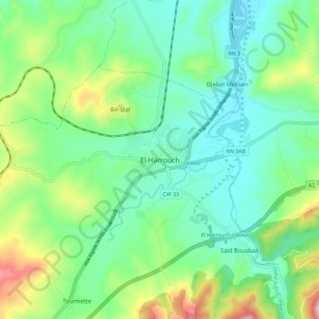
Name: El Harrouch topographic map, elevation, terrain.
Location: El Harrouch, El Harrouch District, Skikda, 21003, Algeria (36.61141 6.79609 36.69141 6.87609)
Average elevation: 174 m
Minimum elevation: 54 m
Maximum elevation: 490 m