
Make a donation
Gear up for your next adventure:
As an Amazon Associate, this site earns from qualifying purchases at no extra cost to you.
Bardos topographic map
Click on the map to display elevation.
Make a donation
Gear up for your next adventure:
As an Amazon Associate, this site earns from qualifying purchases at no extra cost to you.
Bardos
La superficie de la commune est de 4 253 hectares ; l'altitude maximale est de 186 m, sur la butte de Miremont, où se trouvent un ancien manoir du XIVe siècle ainsi qu'un château d'eau aménagé en belvédère surplombant la vallée de l'Adour.
Make a donation
Gear up for your next adventure:
As an Amazon Associate, this site earns from qualifying purchases at no extra cost to you.
About this map
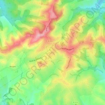
Name: Bardos topographic map, elevation, terrain.
Average elevation: 88 m
Minimum elevation: 1 m
Maximum elevation: 185 m
Make a donation
Gear up for your next adventure:
As an Amazon Associate, this site earns from qualifying purchases at no extra cost to you.