
Thank you for supporting this site ❤️
Make a donation
Make a donation
Gear up for your next adventure:
As an Amazon Associate, this site earns from qualifying purchases at no extra cost to you.
Kengnei topographic map
Click on the map to display elevation.
Thank you for supporting this site ❤️
Make a donation
Make a donation
Gear up for your next adventure:
As an Amazon Associate, this site earns from qualifying purchases at no extra cost to you.
About this map
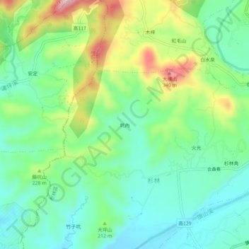
Name: Kengnei topographic map, elevation, terrain.
Location: Kengnei, Shanlin District, Shanlin, Kaohsiung, 846, Taiwan (22.98611 120.52028 23.02611 120.56028)
Average elevation: 186 m
Minimum elevation: 111 m
Maximum elevation: 342 m
Thank you for supporting this site ❤️
Make a donation
Make a donation
Gear up for your next adventure:
As an Amazon Associate, this site earns from qualifying purchases at no extra cost to you.