
Glücksburger Heide topographic map
Interactive map
Click on the map to display elevation.
About this map
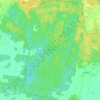
Name: Glücksburger Heide topographic map, elevation, terrain.
Average elevation: 82 m
Minimum elevation: 72 m
Maximum elevation: 96 m
Other topographic maps
Click on a map to view its topography, its elevation and its terrain.
Gerbisbach
Deutschland > Sachsen-Anhalt > Wittenberg > Jessen (Elster)
Gerbisbach, Jessen (Elster), Wittenberg, Sachsen-Anhalt, 06917, Deutschland
Average elevation: 75 m