
Manternach topographic map
Interactive map
Click on the map to display elevation.
About this map
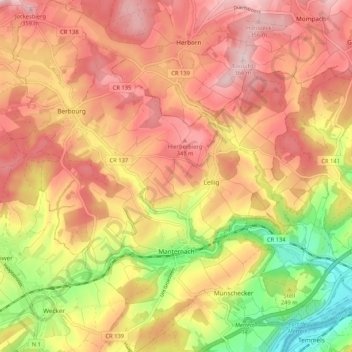
Name: Manternach topographic map, elevation, terrain.
Location: Manternach, Canton Grevenmacher, Luxembourg (49.68783 6.36211 49.75565 6.46173)
Average elevation: 273 m
Minimum elevation: 129 m
Maximum elevation: 369 m