
Chaneng topographic map
Click on the map to display elevation.
About this map
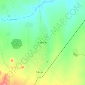
Name: Chaneng topographic map, elevation, terrain.
Average elevation: 1,059 m
Minimum elevation: 1,016 m
Maximum elevation: 1,152 m
Other topographic maps
Click on a map to view its topography, its elevation and its terrain.
Vaalkop Dam
South Africa > North West > Bojanala Platinum District Municipality > Rustenburg Local Municipality
Average elevation: 987 m
Rustenburg Ward 1
South Africa > North West > Bojanala Platinum District Municipality > Rustenburg Local Municipality
Average elevation: 1,125 m
Kgaswane Mountain Nature Reserve
South Africa > North West > Bojanala Platinum District Municipality > Rustenburg Local Municipality
Average elevation: 1,307 m