
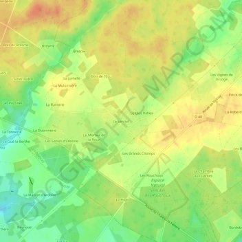
Le Serrain topographic map
Interactive map
Click on the map to display elevation.
About this map
Name: Le Serrain topographic map, elevation, terrain.
Average elevation: 118 m
Minimum elevation: 94 m
Maximum elevation: 136 m
Other topographic maps
Click on a map to view its topography, its elevation and its terrain.
Le Bourg
France > Centre-Val de Loire > Indre-et-Loire > Semblançay
Le Bourg, Semblançay, Chinon, Indre-et-Loire, Centre-Val de Loire, France métropolitaine, 37360, France
Average elevation: 118 m
Bellevile
France > Centre-Val de Loire > Indre-et-Loire > Semblançay
Bellevile, Dolbeau, Semblançay, Chinon, Indre-et-Loire, Centre-Val de Loire, France métropolitaine, 37360, France
Average elevation: 118 m