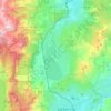
Cold Springs topographic map
Click on the map to display elevation.
About this map
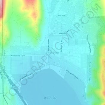
Name: Cold Springs topographic map, elevation, terrain.
Location: Cold Springs, Washoe County, Nevada, 89508, United States (39.66019 -119.99658 39.70019 -119.95658)
Average elevation: 1,573 m
Minimum elevation: 1,530 m
Maximum elevation: 1,805 m
Other topographic maps
Click on a map to view its topography, its elevation and its terrain.
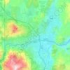
Reno
United States > Nevada > Washoe County
Reno is characterized by its diverse topography, which is shaped by its elevation and the surrounding mountain ranges. Situated at an average elevation of approximately 4,500 feet (about 1,370 meters), the city is nestled in a high desert region that features a mix of flat valleys and gently rolling hills.…
Average elevation: 1,650 m
Reno
United States > Nevada > Washoe County
Reno is just east of the Sierra Nevada on the western edge of the Great Basin at an elevation of about 4,400 feet (1,300 m) above sea level. Numerous faults exist throughout the region. Most of these are normal (vertical motion) faults associated with the uplift of the various mountain ranges, including the…
Average elevation: 1,650 m
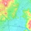
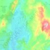
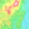
Incline Village-Crystal Bay
United States > Nevada > Washoe County > Incline Village-Crystal Bay
Average elevation: 2,173 m
Spooner Lake & Backcountry State Park
United States > Nevada > Washoe County > Incline Village-Crystal Bay
Average elevation: 2,108 m

Washoe Valley
United States > Nevada > Washoe County
Washoe Valley is a very fire prone area. This is mostly due to the fire fueling vegetation and the topography, with several slopes in the area. Additionally, there is limited water residents can use to protect structures in the case of a fire.
Average elevation: 1,886 m


Rancho San Rafael Regional Park
United States > Nevada > Washoe County > Reno
Average elevation: 1,443 m
Reno
United States > Nevada > Washoe County
Reno is just east of the Sierra Nevada, on the western edge of the Great Basin at an elevation of about 4,400 feet (1,300 m) above sea level. Numerous faults exist throughout the region. Most of these are normal (vertical motion) faults associated with the uplift of the various mountain ranges, including the…
Average elevation: 1,650 m
Reno
United States > Nevada > Washoe County
Reno is just east of the Sierra Nevada, on the western edge of the Great Basin at an elevation of about 4,400 feet (1,300 m) above sea level. Numerous faults exist throughout the region. Most of these are normal (vertical motion) faults associated with the uplift of the various mountain ranges, including the…
Average elevation: 1,650 m

Reno
United States > Nevada > Washoe County
Reno is just east of the Sierra Nevada, on the western edge of the Great Basin at an elevation of about 4,400 feet (1,300 m) above sea level. Numerous faults exist throughout the region. Most of these are normal (vertical motion) faults associated with the uplift of the various mountain ranges, including the…
Average elevation: 1,650 m
Reno
United States > Nevada > Washoe County
Reno is just east of the Sierra Nevada, on the western edge of the Great Basin at an elevation of about 4,400 feet (1,300 m) above sea level. Numerous faults exist throughout the region. Most of these are normal (vertical motion) faults associated with the extension of the earth's lithosphere and the uplift of…
Average elevation: 1,650 m
Reno
United States > Nevada > Washoe County
Reno is just east of the Sierra Nevada, on the western edge of the Great Basin at an elevation of about 4,400 feet (1,300 m) above sea level. Numerous faults exist throughout the region. Most of these are normal (vertical motion) faults associated with the extension of the earth's lithosphere and the uplift of…
Average elevation: 1,650 m
Incline Village-Crystal Bay
United States > Nevada > Washoe County > Incline Village-Crystal Bay
Average elevation: 2,173 m
Reno
United States > Nevada > Washoe County
Reno is just east of the Sierra Nevada, on the western edge of the Great Basin at an elevation of about 4,400 feet (1,300 m) above sea level. Numerous faults exist throughout the region. Most of these are normal (vertical motion) faults associated with the extension of the earth's lithosphere and the uplift of…
Average elevation: 1,650 m