Geolocate

Arona topographic map

Click on the map to display elevation.

About this map
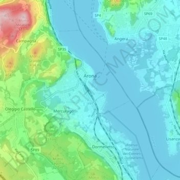
Name: Arona topographic map, elevation, terrain.

Location: Arona, Novara, Piedmont, Italy (45.72521 8.49664 45.78496 8.57964)

Average elevation: 249 m

Minimum elevation: 190 m

Maximum elevation: 517 m

Other topographic maps

Click on a map to view its topography, its elevation and its terrain.

Case Sparse di Cameriano

Italy > Piedmont > Novara > Casalino > Cameriano

Average elevation: 141 m

Agrate

Italy > Piedmont > Novara

Average elevation: 324 m

Gaggiolo

Italy > Piedmont > Novara

Average elevation: 211 m

Pisogno

Italy > Piedmont > Novara > Miasino

Average elevation: 527 m

Gear up for your next adventure:

🧺Mesh Stuff Sacks - Breathable storage for wet gear or camp organization
🧢Thermal Beanie Hats - Prevent heat loss from the head in windy summit conditions
🔥Reusable Hand Warmers - Maintain dexterity in your fingers for precise map handling
🧣Fleece Neck Warmers - Extra insulation for winter topographic surveys
🍲Portable Camping Stoves - Fast-boiling stoves for hot meals on remote topographic survey trips

As an Amazon Associate, this site earns from qualifying purchases at no extra cost to you.