
Bristol topographic map
Click on the map to display elevation.
About this map
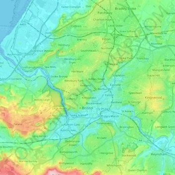
Name: Bristol topographic map, elevation, terrain.
Location: Bristol, West of England, England, United Kingdom (51.39728 -2.71837 51.54443 -2.51042)
Average elevation: 55 m
Minimum elevation: -3 m
Maximum elevation: 230 m
Bristol trails, hiking, mountain biking, running and outdoor activities