
Bolande topographic map
Interactive map
Click on the map to display elevation.
About this map
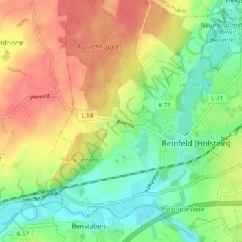
Name: Bolande topographic map, elevation, terrain.
Average elevation: 31 m
Minimum elevation: -1 m
Maximum elevation: 67 m
Other topographic maps
Click on a map to view its topography, its elevation and its terrain.
Lehmkamp
Deutschland > Schleswig-Holstein > Stormarn > Reinfeld
Lehmkamp, Reinfeld, Stormarn, Schleswig-Holstein, 23858, Deutschland
Average elevation: 27 m