
Thank you for supporting this site ❤️
Make a donation
Make a donation
Gear up for your next adventure:
As an Amazon Associate, this site earns from qualifying purchases at no extra cost to you.
Lamadi topographic map
Click on the map to display elevation.
Thank you for supporting this site ❤️
Make a donation
Make a donation
Gear up for your next adventure:
As an Amazon Associate, this site earns from qualifying purchases at no extra cost to you.
About this map
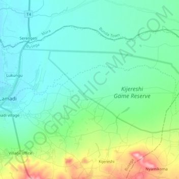
Name: Lamadi topographic map, elevation, terrain.
Location: Lamadi, Busega, Simiyu, Lake Zone, Tanzania (-2.25880 33.84209 -2.21548 33.99895)
Average elevation: 1,168 m
Minimum elevation: 1,135 m
Maximum elevation: 1,286 m
Thank you for supporting this site ❤️
Make a donation
Make a donation
Gear up for your next adventure:
As an Amazon Associate, this site earns from qualifying purchases at no extra cost to you.