
Thank you for supporting this site ❤️
Make a donation
Make a donation
Gear up for your next adventure:
As an Amazon Associate, this site earns from qualifying purchases at no extra cost to you.
Schöna topographic map
Click on the map to display elevation.
Thank you for supporting this site ❤️
Make a donation
Make a donation
Gear up for your next adventure:
As an Amazon Associate, this site earns from qualifying purchases at no extra cost to you.
About this map
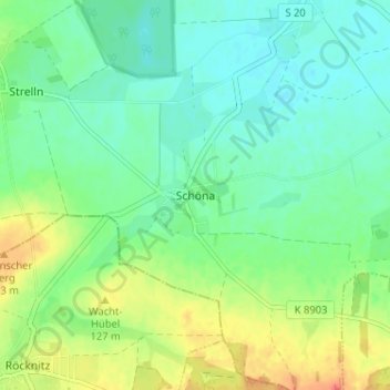
Name: Schöna topographic map, elevation, terrain.
Location: Schöna, Mockrehna, Nordsachsen, Sachsen, 04862, Deutschland (51.45071 12.79023 51.49071 12.83023)
Average elevation: 112 m
Minimum elevation: 97 m
Maximum elevation: 141 m
Thank you for supporting this site ❤️
Make a donation
Make a donation
Gear up for your next adventure:
As an Amazon Associate, this site earns from qualifying purchases at no extra cost to you.